


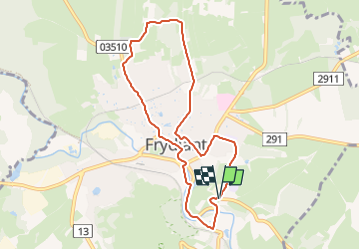

8,5 km | 12,5 km-effort

Tous les sentiers balisés d’Europe GUIDE+


Kostenlosegpshiking-Anwendung
 SityTrail
IGN / Geografische Institute
SityTrail World
Die Welt öffnet sich für Sie
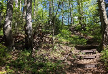
Tour Zu Fuß von 7,3 km verfügbar auf Nordosten, Reichenberger Region, Friedland in Böhmen. Diese Tour wird von SityTrail - itinéraires balisés pédestres vorgeschlagen.
Tour erstellt von cz:KČT.


![Tour Zu Fuß Kratzau - [Ž] Chrastava - Bedřichovský les - Photo](https://media.geolcdn.com/t/375/260/592d5d26-6f35-4f32-b996-51a61a06f566.jpeg&format=jpg&maxdim=2)
Zu Fuß
![Tour Zu Fuß Ringelshain - [Z] Rynoltice -Jitrava - Photo](https://media.geolcdn.com/t/375/260/6d77d54b-5bfe-486d-be52-f4a62639b639.jpeg&format=jpg&maxdim=2)
Zu Fuß
Zu Fuß
![Tour Zu Fuß Tannwald - [Ž] Dolní Smržovka - Příchovice - Photo](https://media.geolcdn.com/t/375/260/4c26dccd-1d48-48a7-8af8-bd60db9f583d.jpeg&format=jpg&maxdim=2)
Zu Fuß
![Tour Zu Fuß Christofsgrund - [M] Výpřež - Novina - Photo](https://media.geolcdn.com/t/375/260/71803f80-2c0c-496d-ad1d-7e0e8f6a53b1.jpeg&format=jpg&maxdim=2)
Zu Fuß
![Tour Zu Fuß Reichenberg - [Č] Liberec - Bedřichov - Photo](https://media.geolcdn.com/t/375/260/0b60d83f-f733-49d5-8597-509f03ca9ef2.jpeg&format=jpg&maxdim=2)
Zu Fuß
Zu Fuß
![Tour Zu Fuß Georgenthal - [Z] Tanvald - Jiřetín pod Bukovou - Photo](https://media.geolcdn.com/t/375/260/0e5ae53e-d867-4602-a9f5-30cb743ff205.jpeg&format=jpg&maxdim=2)
Zu Fuß
Zu Fuß